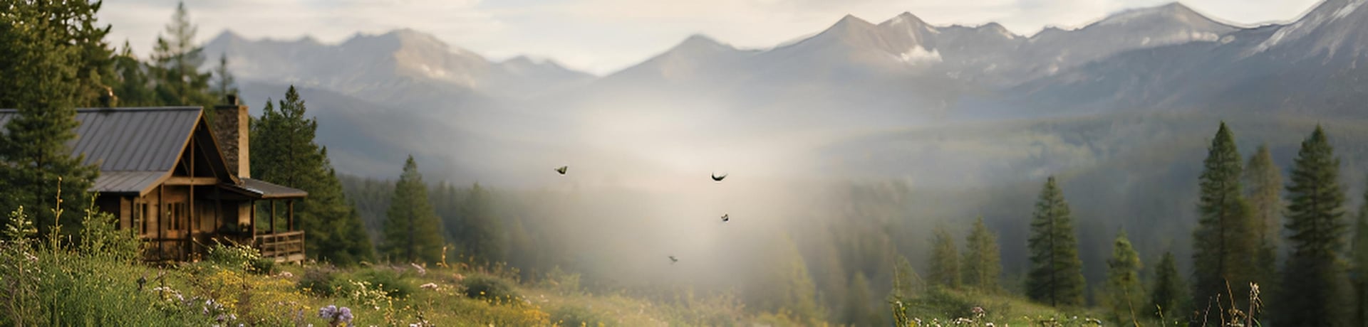
Neighbors helping neighbors stay firesafe
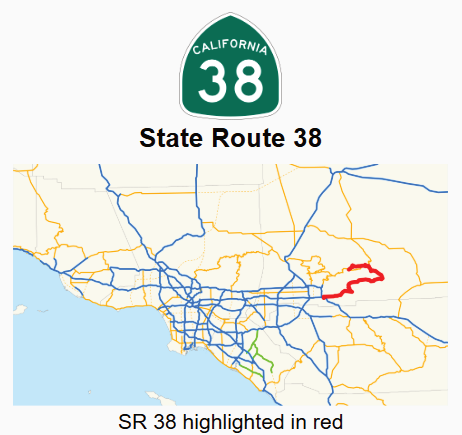
State Route 38
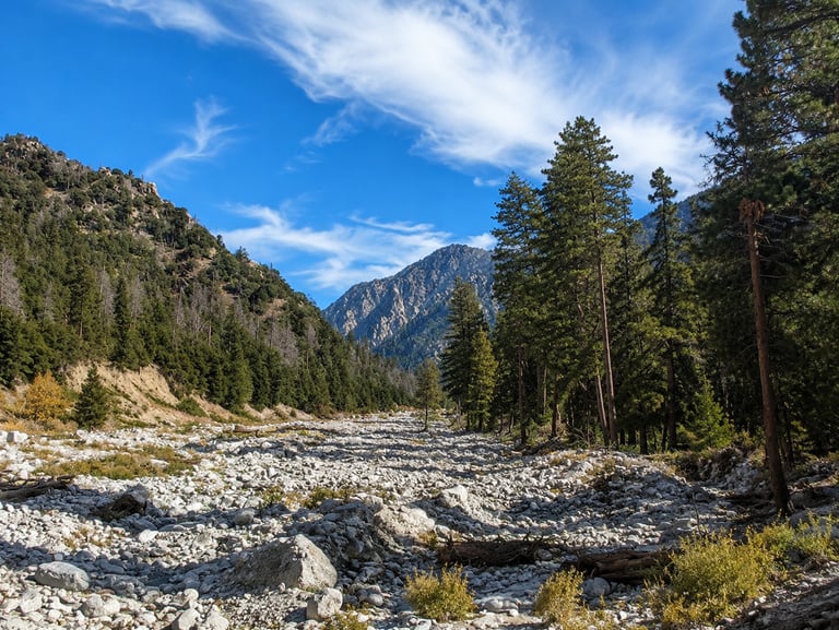
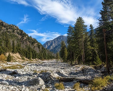
Mill Creek Canyon in San Bernardino County
Mill Creek Canyon along State Route 38 is one of the most scenic and forested stretches leading into the San Bernardino Mountains, offering a blend of natural beauty, mountain history, and outdoor recreation.
Located within the San Bernardino National Forest between Mentone and Angelus Oaks, Mill Creek Canyon follows California State Route 38, part of the Rim of the World Scenic Byway. Known for its gradual climb, sweeping canyon views, and less congested travel experience, SR 38 provides an alternative route to Big Bear Lake compared to the busier Highway 18 corridor.
California State Route 38 (SR 38)
State Route 38 begins near Interstate 10 in Redlands and winds through the San Bernardino Mountains before connecting with State Route 18 near Big Bear Lake.
Mill Creek Canyon forms part of the eastern corridor of SR 38, where the highway travels through a rugged canyon landscape bordered by the Yucaipa Ridge to the south and the San Bernardino Mountains to the north.
Within the canyon area, Mill Creek Road branches west toward Forest Falls and the Big Falls recreation area, while SR 38 continues upward through a series of mountain switchbacks toward Angelus Oaks.

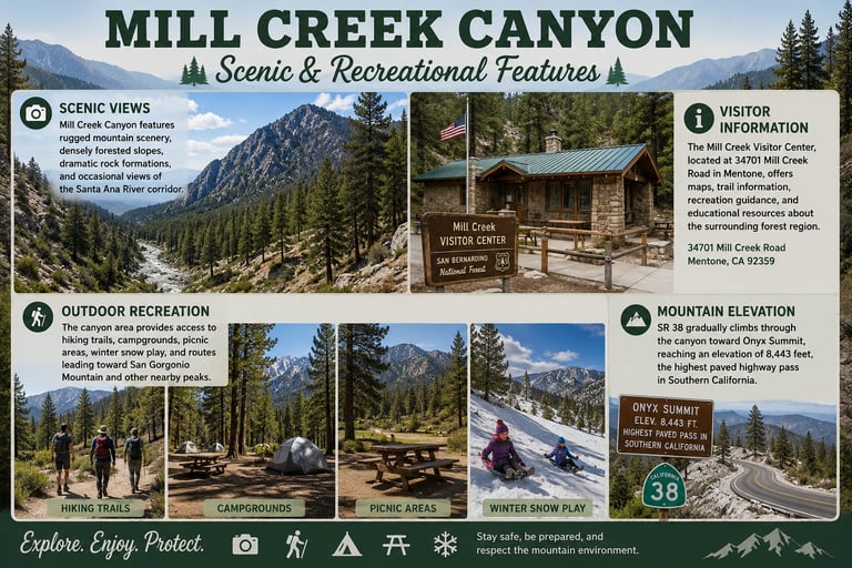
Scenic and Recreational Features
Scenic Views: Mill Creek Canyon features rugged mountain scenery, densely forested slopes, dramatic rock formations, and occasional views of the Santa Ana River corridor.
Visitor Information: The Mill Creek Visitor Center, located at 34701 Mill Creek Road in Mentone, offers maps, trail information, recreation guidance, and educational resources about the surrounding forest region.
Outdoor Recreation: The canyon area provides access to hiking trails, campgrounds, picnic areas, winter snow play, and routes leading toward San Gorgonio Mountain and other nearby peaks.
Mountain Elevation: SR 38 gradually climbs through the canyon toward Onyx Summit, reaching an elevation of 8,443 feet, the highest paved highway pass in Southern California.
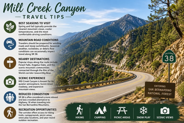
Travel Tips
Best Seasons to Visit: Spring and fall typically provide the clearest mountain views, cooler temperatures, and the most comfortable driving conditions.
Mountain Road Conditions: Travelers should be prepared for winding roads and steep switchbacks. Seasonal weather, rockslides, or debris flow conditions can occasionally impact travel along SR 38.
Nearby Destinations: Popular stops along the route include Forest Falls, Angelus Oaks, and the scenic mountain communities connected through the Rim of the World corridor toward Big Bear.
Scenic Experience: Mill Creek Canyon is known for its quieter atmosphere, forest-lined roadway, and expansive mountain views.
Reduced Congestion: SR 38 is often considered a more relaxed and less crowded alternative to Highway 18 when traveling into the San Bernardino Mountains.
Recreation Opportunities: The corridor offers access to hiking trails, campgrounds, picnic areas, snow play locations, and year-round outdoor recreation.

Phone
place holder
© 2025 Mill Creek Canyon Fire Safe Council, DBA FireSafe38.org • Serving Forest Falls & Mountain Home Village
FOLLOW US